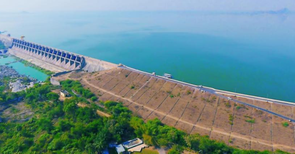
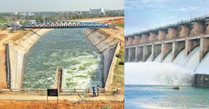
The Lower Manair Dam is an impressive infrastructure project situated on the Manair River, a tributary of the Godavari River. Located in the Karimnagar district of Telangana, India, this dam is crucial for regional irrigation, flood control, and drinking water supply.

History of Lower Manair Dam
The Lower Manair Dam began construction in 1974 and was finished in 1985. It was built across the Manair River, a tributary of the Godavari River, in the Alugunur village of Thimmapur mandal at the confluence with the Mohedamada River. The dam was primarily intended to regulate the flow of water below the Kakatiya Canal, ensuring a stable water supply for irrigation purposes. It also acts as a balancing reservoir for the Kakatiya Canal and provides irrigation to 400,000 acres of land. The LMD is known as the “water gateway into the district” and is often the first sight visitors see when entering Karimnagar.
Construction of Lower Manair Dam
The Manair Dam is built across the Manair River, near the village of Thimmapur in Karimnagar district. The primary objectives of the dam are to provide irrigation facilities to nearby agricultural lands, supply drinking water to the local population, and control floods.

- Foundation and Structure: The dam is a composite structure featuring both earthen and concrete components. The foundation work involved extensive geological studies to ensure stability and durability. The dam’s construction required significant earthworks and the installation of robust spillways to manage excess water during monsoon seasons.
- Dimensions: The dam has a height of approximately 26 meters (85 feet) and a length of about 1,300 meters (4,265 feet). Its reservoir, known as the Lower Manair Dam Reservoir, can hold a substantial volume of water, which is crucial for the dam’s intended purposes.
- Key Features: The dam includes several key features such as:
- Spillways: Designed to handle overflow and prevent dam failure during heavy rains.
- Outlet Structures: These are used to release water for irrigation and flood management.
- Hydrological Control: Advanced systems are in place to monitor and manage water levels.
Also Read: Vemulawada Raja Rajeshwara Temple: An Exclusive Journey Through History
Benefits of Dam

- Irrigation: The Lower Manair provides water to thousands of hectares of agricultural land in the region. This has significantly boosted agricultural productivity and improved the livelihoods of local farmers.
- Drinking Water Supply: The dam plays a crucial role in supplying drinking water to urban and rural areas in the Karimnagar district.
- Flood Control: By regulating the flow of the Manair River, the dam helps mitigate the risk of floods, which can be devastating to nearby communities.
- Economic Impact: The availability of water has stimulated local economic activities, including agriculture and small-scale industries.
Challenges and Issues
Despite its benefits, the Lower Manair has faced several challenges:
- Sedimentation: Over time, sedimentation can reduce the dam’s storage capacity, affecting its efficiency.
- Maintenance: Regular maintenance is required to ensure the dam’s structural integrity and operational effectiveness.
- Environmental Concerns: The dam’s construction and operation have raised environmental concerns, including the impact on local ecosystems and wildlife.
Also Read: A Complete Pilgrim’s Guide to Kondagattu Sri Anjaneya Swamy Devasthanam
Future Prospects
The future of the Dam involves ongoing efforts to enhance its efficiency and address any emerging issues. This includes regular maintenance, sediment management, and monitoring of environmental impacts. There is also potential for integrating advanced technologies to improve water management and resource utilization.
Other Attractions Near Lower Manair Dam

1. Deer Park:
- Location: Situated close to the Lower Manair Dam.
- Description: The Deer Park is a serene spot, offering visitors a chance to observe deer and other local wildlife in a natural habitat. It’s a great place for a family outing, especially for children who enjoy watching animals.
2. Ujwala Park:
- Location: Near the Lower Manair Dam.
- Description: Ujwala Park is a well-maintained recreational area ideal for picnics and strolls. The park is adorned with lush greenery, walking paths, and children’s play areas, making it a popular spot for locals and tourists alike.
3. Kakatiya Karanam Sagar Reservoir:
- Location: Close to the Lower Manair Dam.
- Description: The Kakatiya Karanam Sagar Reservoir is another scenic water body in the vicinity, popular among visitors for its peaceful environment and beautiful landscapes. It’s a perfect place for those looking to enjoy nature and the tranquility of water bodies.
How to reach the Lower Manair Dam
- By Road: The dam is just 6 kilometers from Karimnagar town. You can take a taxi, auto-rickshaw, or drive by car.
- By Bus: Regular buses run from Karimnagar to nearby villages, with stops close to the dam.
- By Train: The nearest railway station is Karimnagar. From there, take a taxi or local transport to the dam.
- By Air: The closest airport is Rajiv Gandhi International Airport in Hyderabad, about 165 kilometers away. From there, you can hire a taxi or take a bus to Karimnagar, and then proceed to the dam.
Conclusion
The Lower Manair Dam stands as a testament to modern engineering and its role in managing water resources. Its contributions to irrigation, drinking water supply, and flood control underscore its importance to the Karimnagar district and the wider Telangana region. As it continues to serve its purposes, the dam also presents opportunities for further improvements and innovations in water management.
Frequently Asked Questions(FAQs)
A: The Lower Manair Dam primarily serves irrigation, drinking water supply, and flood control.
A: The construction of the Lower Manair Dam began in 1974 and was completed in 1985.
A: The Lower Manair Dam has a height of approximately 26 meters (85 feet).
A: The dam faces challenges such as sedimentation, maintenance needs, and environmental concerns.
A: The dam provides irrigation to approximately 400,000 acres of land.


